Services

Marine Engineering
Site assessments, feasibility & FEED studies
Hydrodynamic loading, moorings analysis & fatigue calculations
Marine ops planning (storyboarding, weather windows)
Cost modelling (CapEx/OpEx/DecEx, Yield, LCoE)
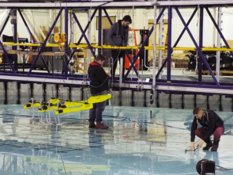
Scale model tank testing (design/running of experiments)
Due diligence, standards compliance & technical advisory

Acquisition & Modelling
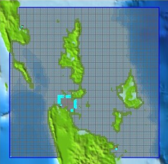
Legacy data sourcing & curation
In-situ data collection + access to a network of specialists
In-house + partnered numerical modelling
Proxy data synthesis using AI/ML techniques

Analysis & Visualisation
Raw data cleaning, formatting & parameterisation
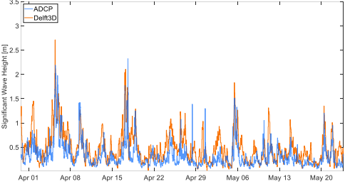
Metocean analytics (seasonality, extremes, joint probabilities)
Custom dashboards & visualisation
Live-data integration, process efficiency & advanced reporting